Select the Waypoints tab from the BioBase trip viewer to view the Waypoint upload tool. The Waypoint upload tool allows you to manage the selected trip by manually adjusting coordinates or adding additional details where data collection was not possible.
 |
|
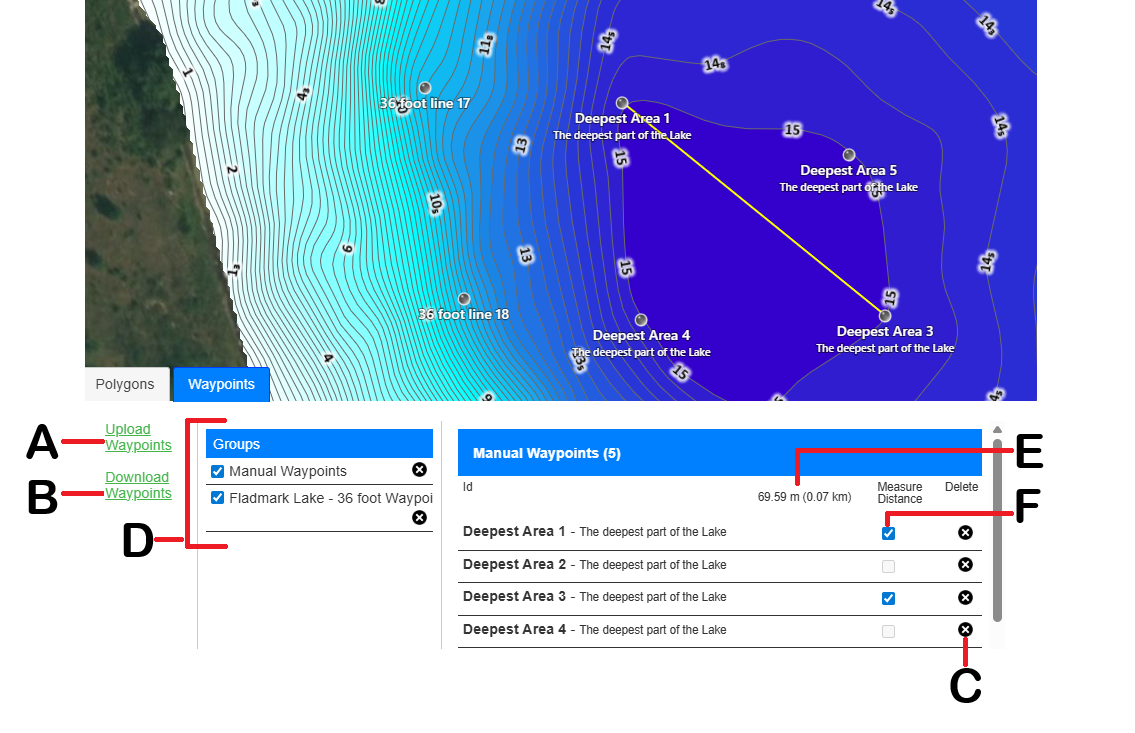
| A | Upload waypoint link |
| B | Download waypoint link |
| C | Delete waypoint group |
| D | Waypoints or Waypoint Groups |
| E | The measured distance between Waypoints |
| F | Checkbox for measuring between Waypoints |
Adding new waypoints manually
When the selected trip is displayed in the BioBase trip viewer, you can add up to 1,000 waypoints to any position on the track.
To manually add a new waypoint, right click the preferred position and select Add Waypoint.
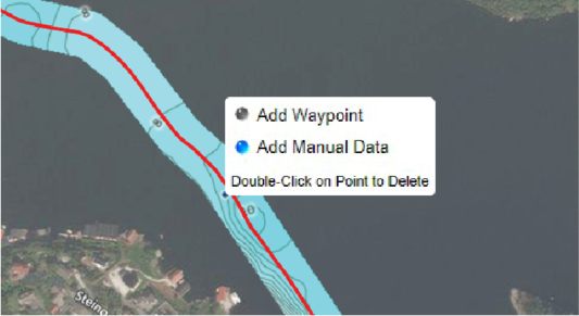
Saving a waypoint
Once you marked your waypoint, the Create New Waypoint dialog is displayed. You must enter the Name/Label and a Comment is optional before saving the waypoint. Once saved, the manually added waypoints is listed in the Waypoints tab.
Measuring the distance between 2 waypoints
To Measure the distance between 2 waypoints, click in the box (F shown in the image above) of any 2 waypoints in the same Waypoint Group. Once you have selected the waypoints the distance will be shown and a yellow line will appear in the map between the selected waypoints.
Uploading a *.gpx waypoint file
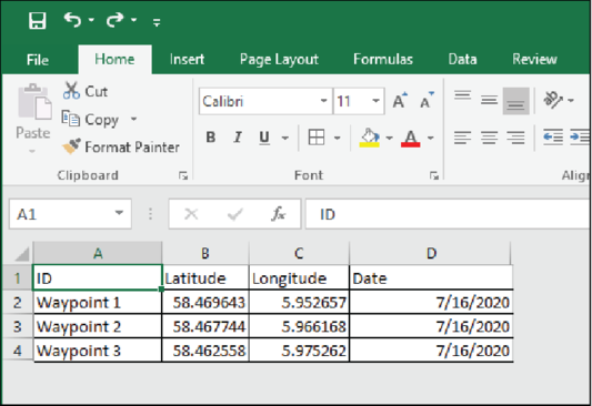
Uploading a *.csv waypoint file
-
File contains columns headers in the first row.
-
File contains commas to separate columns.
-
File does not contain pipe characters ("|").
-
File contains the required columns with the following named headers:
- Latitude
- Longitude
- ID
- Date
-
Format of the "date" field is UTC and formatted as:
- MM/dd/yyyy
- MM/dd/yyyy HH.mm.ss
-
File contains a maximum of eight columns (i.e. the four required columns plus a maximum of four additional columns).
-
The order of the coulmns does not matter as long as the required columns are properly named and present.
The image below is an example of a *.csv spreadsheet:
Downloading waypoints
You can download your waypoints added in the selected trip. Use the Download waypoint Link found in the Waypoint tab to download the waypoints into *.gpx format.
Deleting waypoints
To delete either a waypoint group or individual waypoints, click the black X on the Waypoints tab.