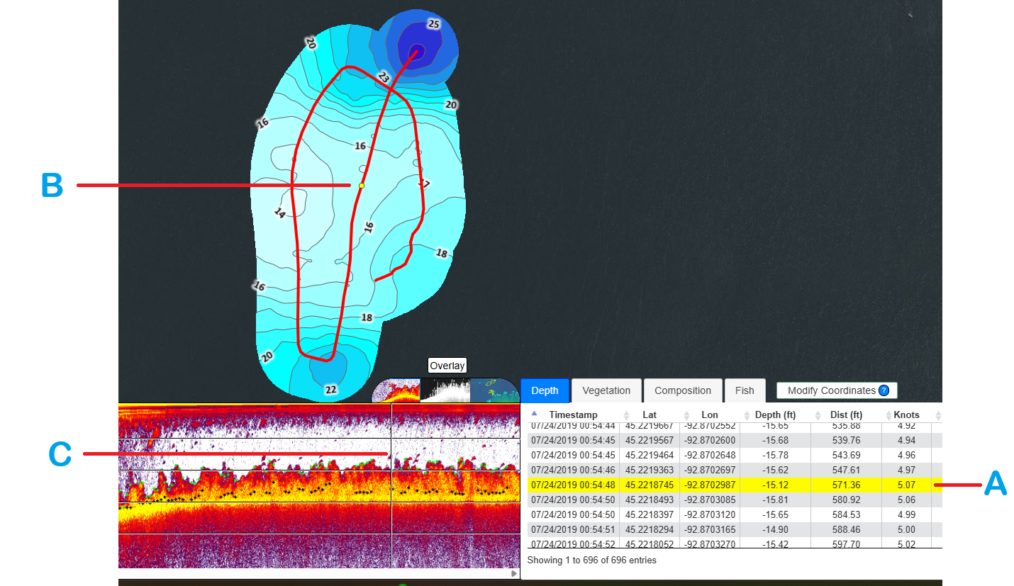
The processed depth coordinate point data associated to the trip selected in the BioBase trip viewer are listed in the Depth tab (not available for merges).
When you select a row in the Depth tab, it is highlighted with color yellow (A). The highlighted row is positioned according to the location of the yellow dot displayed on the track (B) and the appropriate position in the sonar imagery (C).
Deleting bathymetry/contours
For various reasons, a user may need to delete erroneous data and create an updated map.
You can delete selected or multiple ranges of depth data.
To delete a selected data range, tick on the checkboxes and click the Delete Selected Coordinates button.
To delete a large/multiple data range, click the Modify Coordinates button found above the table tabs.
By clicking the button, a dialog box is displayed. Use the dialog to specify the range of data you want to delete and/or replace with different values of depth or vegetation. You cannot modify the values of the composition data (delete only).
To update the changes made to your trip, you must reprocess the trip. Refer to the Trip Reprocessing section described in this manual.
Deleting bathymetry/contours by dragging to select
You can use the map to drag a box around large areas of a map to delete in bulk. Ensure you are zoomed into the relevant area, then hold down Shift and drag a box around the tracks/points you'd like to delete.
Selecting the points to delete:
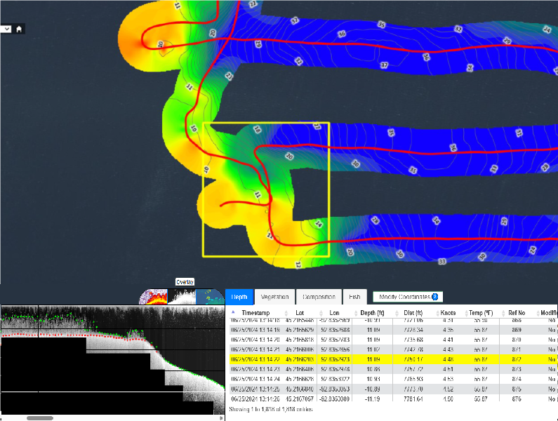
After deleting the selected points and reprocessing the trip the sleected reference numbers are now deleted.