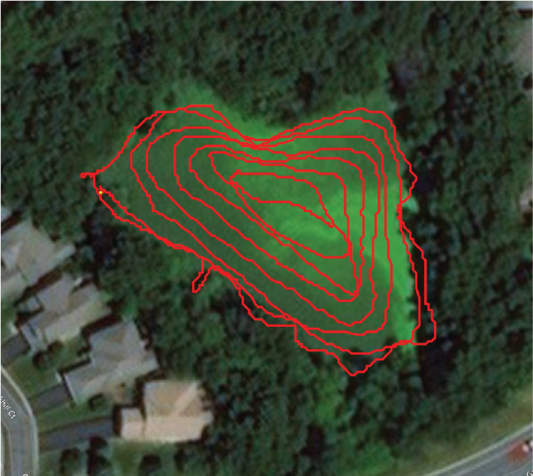
To generate optimal bathymetric maps, users should design transects parallel to shore and record data along a concentric path starting at close to shore and working their way inward to the middle of the water body.
Example of concentric circle transect design
The image below is an example of a concentric circle transect design for optimal bathymetric sampling in a storm water retention ponds.
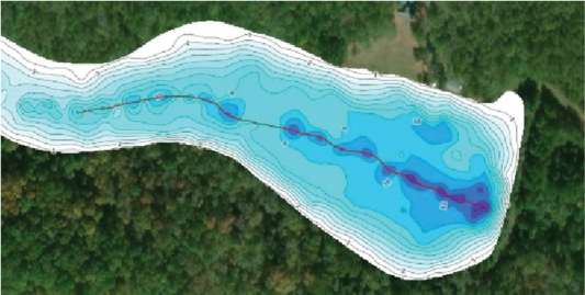
Example of a trip to a narrow thalweg or deep channel
The image below shows a red line depicting the direction of travel needed to smoothly map riverbed channels. Efforts should be made to travel parallel to any narrow thalweg or deep channel.